Imagine easing off your lift, coffee in hand, and pointing your bow toward Pine Island Sound before breakfast. In Cape Coral, that scene is real life thanks to a planned canal network with more than 400 miles of waterways that link many homes to the Caloosahatchee River and the Gulf of Mexico. If you are exploring a move here or upgrading your current setup, understanding canal types, routes, marinas, permits, and seasons will shape your day-to-day. This guide breaks it all down so you can match your boating style to the right home and location. Let’s dive in.
What gulf access means here
Not every canal offers the same route to open water, so access type matters. The City’s system includes direct gulf-access canals, river-access routes that feed into the Caloosahatchee, bridge-restricted canals with vertical limits, and interior canals that do not lead out. Start by confirming the specific route from any home you are considering. The city’s overview of waterways is a helpful starting point for context on how the network connects to beaches and the river (City of Cape Coral canal overview).
Direct gulf access
These canals avoid low fixed bridges and other vertical barriers, so larger powerboats and many sailboats can move freely. You get the quickest runs to the river, Pine Island Sound, and the Gulf. If you own a taller boat or have a tower, this is often the most convenient option. Many buyers prioritize these lots for speed and flexibility.
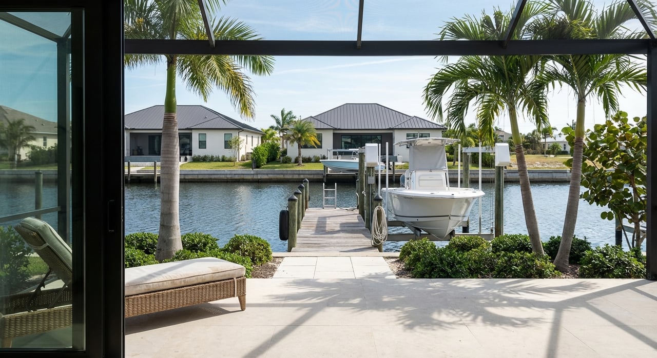
River-access routes
Most gulf-access homes reach the Caloosahatchee River first, then head west toward Pine Island Sound. For typical center consoles and bay boats, runs can be quick, though times vary with boat speed and tides. You enjoy easy restaurant runs and day trips, and offshore fishing is realistic in a single day. Always check charts for bridge clearances along your chosen route.
Bridge-restricted canals
Some neighborhoods require passing under fixed bridges, which limit mast or hard-top height. Center consoles, pontoons, and smaller cruisers usually fit; tall sailboats and big sportfishers often do not. Verify clearances on nautical charts before assuming a route is sailboat friendly. Planning ahead helps you avoid costly surprises (U.S. Coast Pilot guidance).
Interior or no-exit canals
These canals and basins offer quiet water views and are great for kayaking and casual fishing. They do not provide practical cruising to the river or Gulf without trailering. If your lifestyle is more about dockside living and paddle time than long runs, this can still be a fit. Just be clear on your goals before you buy.
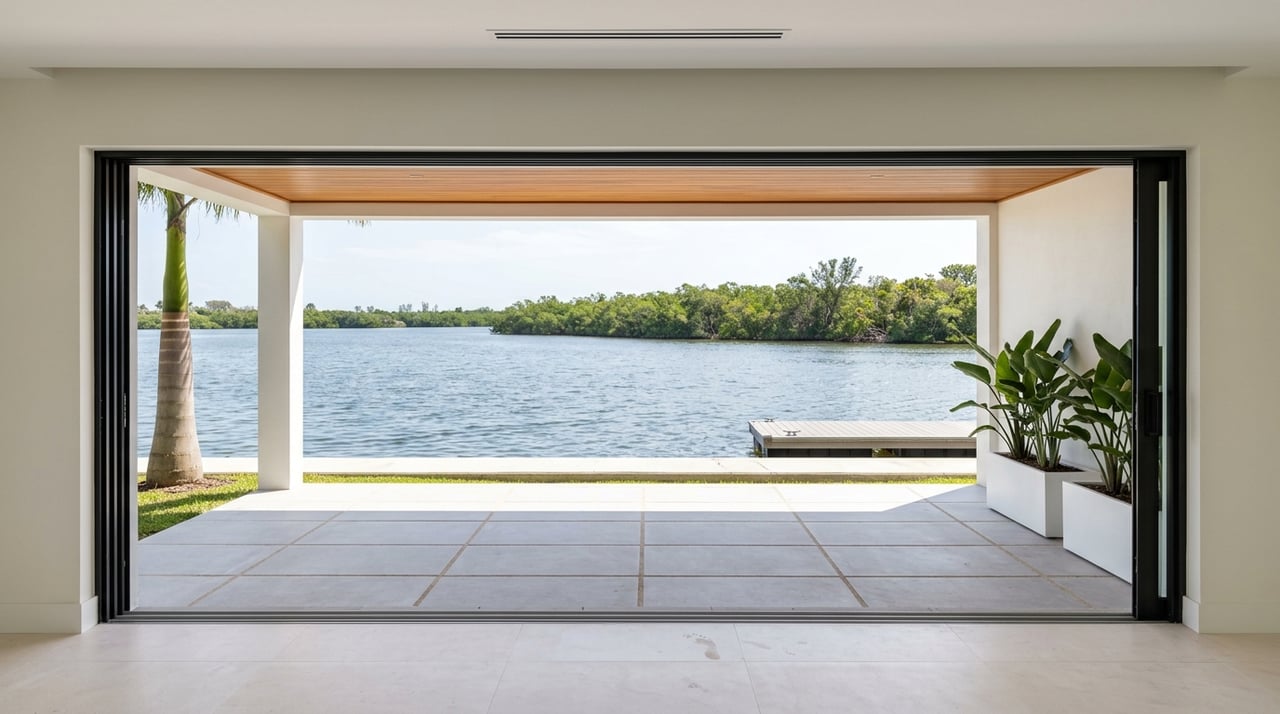
Day-to-day boating rhythms
With direct or near-river access, short outings become part of your week. You can plan 30 to 90 minute runs to barrier-island beaches, dock-and-dine lunches, and inshore fishing trips, depending on boat speed, tides, and your chosen pass. If you are in a bridge-restricted area, you might lean into sunrise cruises, backwater casting, and sunset rides close to home. Either way, the canal lifestyle keeps you on the water often.
Launches, marinas, and dock-and-dine
If your property is not on a gulf-access canal, you will likely use public ramps. Cape Coral maintains improved ramps like BMX, Burnt Store, Horton Park, and Rosen Park, along with a daily and annual trailer parking program. You can review locations, hours, and decals on the city’s ramps and parking page (City ramps and parking program).
Tarpon Point and Cape Harbour anchor the marina scene with wet slips, fuel, and services, plus restaurants for boat-in meals. Local favorites like Rumrunners, Fathoms, and the Boathouse Tiki Bar offer the classic dock-and-dine vibe. Before you go, confirm current docking rules and hours. For a feel of the waterfront dining circuit, browse this regional roundup (waterfront restaurants overview).
Recent waterway changes
The Chiquita Boat Lock, once a control point between the SW Spreader and the river, was removed in mid 2025. The removal is part of a broader enhancement effort intended to improve tidal flow and navigation patterns in parts of southern Cape Coral. You will notice route changes if you boat in that system, so allow time to learn the new flow and markers. Local reporting has tracked the updates and timelines (Chiquita Lock removal coverage).
Water quality and ecology
Tides, circulation, and seasonal conditions shape local water experiences. City and regional partners have pursued projects to improve flushing and habitat, including mangrove plantings and oyster work in spreader systems. Seasonal events like algal blooms or freshwater discharges can affect clarity and fisheries, so stay informed and plan flexible outings. For context on canal circulation and environmental issues, review regional commentary and updates (Calusa Waterkeeper overview).
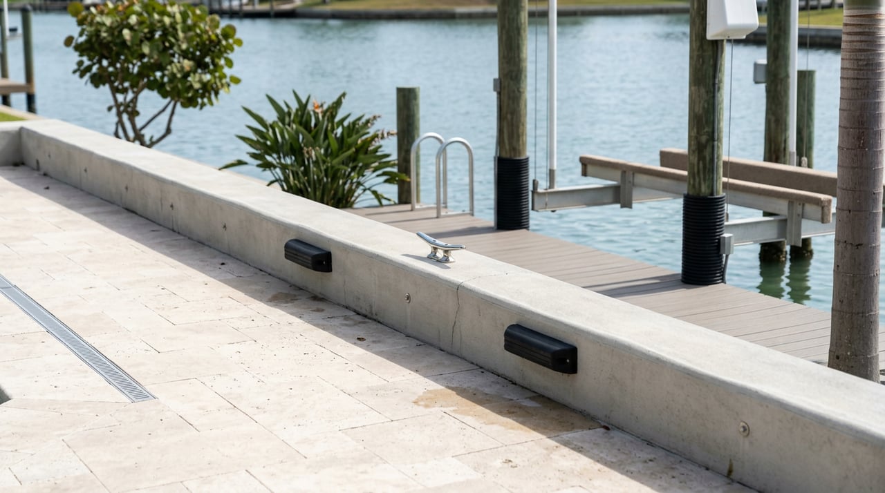
Rules, permits, and dock planning
Cape Coral treats waterways as public navigation corridors with shared rights. Private docks cannot encroach on navigation lanes, and the city enforces mooring and placement rules through its Marine Services team. If you are planning dockage or mooring patterns, start with the city’s guidance on public-water easements and marine services (Marine Services overview).
City code requires permits for seawalls, docks, canopies, boat lifts, and davits. In saline or brackish areas, seawalls are required and must be maintained, and marine improvements have rules on setbacks, projections, and placement relative to your water frontage. These details affect whether you can add a large lift or canopy quickly and what it will cost. Review the marine improvements section of the code before you plan work (City code §3.16 marine improvements).
Safety and seasonality on the canals
Idle speed and wake zones
Many canals and sensitive areas are posted as idle speed or no-wake. That means operating at the slowest speed that keeps steerage and produces no wake. Obeying markers protects seawalls, docks, and habitat and keeps neighbors safe (Coast Pilot definitions).
Boater education basics
Florida requires boater education for certain operators, and local agencies encourage safe operation and life jacket use. The city’s Marine Services pages point you to the latest state resources and reminders. If you are new to the area, a local safety course is a smart first step before exploring longer routes (Marine Services overview).
Hurricane season planning
Atlantic hurricane season runs June 1 through November 30, with a mid August to October peak. Waterfront owners typically secure or haul boats, inspect lifts and lines, and review insurance and evacuation plans ahead of storms. Build a checklist and act early so you are not scrambling when a watch is issued. For official dates and advisories, follow the National Hurricane Center (NHC official site).
Buyer checklist for canal life
Use this quick list to align your daily boating goals with the right home:
- Confirm canal type and route. Is it direct gulf access, river access, bridge restricted, or interior? Use charts and the city’s waterway overview to verify paths (canal overview).
- Ask for permit history. Look for seawall, dock, and lift permits and any recorded dredging or marine improvements. Missing history can slow projects or add cost (City code §3.16).
- Inspect seawall and dock. Bring in a qualified inspector and budget for repairs that require permits and approvals. Seawalls and lifts are material investments.
- Map your daily convenience. Note your nearest public ramp, fuel dock, and slip options if needed. Review the city’s ramps and parking program before you trailer (ramps and parking).
- Learn local navigation. Ask about shoaling and recent dredging on your canal and route. Depths can vary seasonally, so do not assume uniform water under your keel.
Is canal living right for you?
If you picture spontaneous sunset cruises, dock-and-dine lunches, and quick fishing runs, Cape Coral’s gulf-access canals deliver. Match your boat and routine to the right canal type, and you will spend more time enjoying the water and less time solving for bridges or permits. With a clear plan for docks, lifts, and seasonal prep, canal life feels easy and rewarding.
Ready to align your boating lifestyle with the perfect Cape Coral property? Work with Heather Porrett to evaluate seawalls, docks, routes, and permit history, then find the waterfront home that fits your goals.
FAQs
Do all Cape Coral waterfront homes reach the Gulf?
- No. Some are direct gulf access, many route through the Caloosahatchee River, some have bridge restrictions, and interior canals do not lead out. Always confirm the specific route you will use.
Which boat types fit most Cape Coral canals?
- Center consoles, pontoons, bay boats, and small cruisers are common. Tall sailboats and large sportfishers need deep, bridge-free routes, so verify clearances on your path.
Where can you launch without a private dock?
- Use city ramps such as BMX, Burnt Store, Horton Park, or Rosen Park and follow the trailer parking program rules posted by the city.
How does hurricane season affect daily boating?
- Expect more prep than play when storms approach. Secure or haul boats, inspect lifts and lines, and follow official guidance from the National Hurricane Center during the June to November season.
What permits do you need for a new dock or lift?
- City permits are required for docks, lifts, canopies, and seawalls, and some projects also need state or federal approvals. Review Cape Coral’s marine improvements code and plan timelines accordingly.