Does “Gulf access” really mean your boat can reach the Gulf from a Cape Coral dock? Sometimes, but the details matter. Bridges, canal depth, turning room, and route options can turn an easy cruise into a tricky plan. You want clear answers before you buy. In this guide, you’ll get plain-English definitions, a simple way to match your boat to a property, and a due diligence checklist you can use right away. Let’s dive in.
What “Gulf access” means in Cape Coral
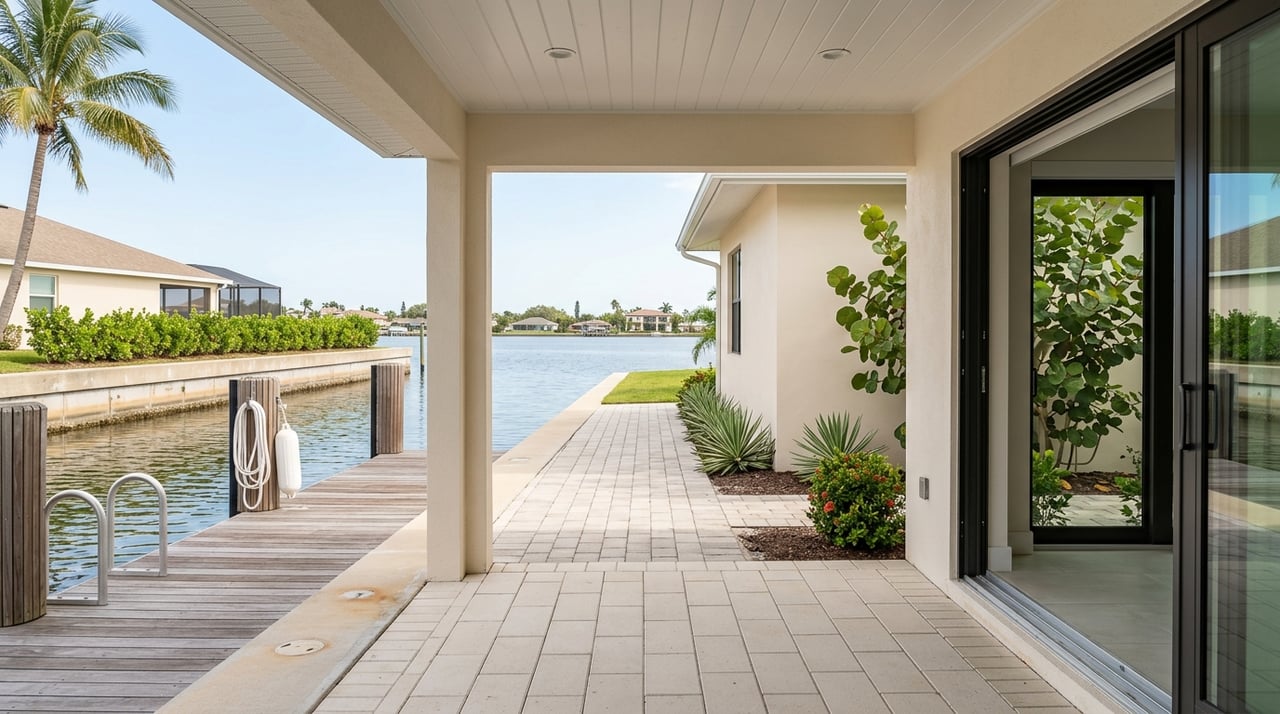
“Gulf access” is often used as a marketing phrase. In practice, you should confirm whether a property’s canal truly connects to open water and whether your boat can pass under or around bridges on the route. Focus on four things: waterway connectivity, vertical clearance, turning room, and minimum depth.
MLS labels like “waterfront” or “gulf access” are helpful starting points, but they do not guarantee mast clearance or year-round navigability. Treat them as clues, not proof.
Three access types that matter
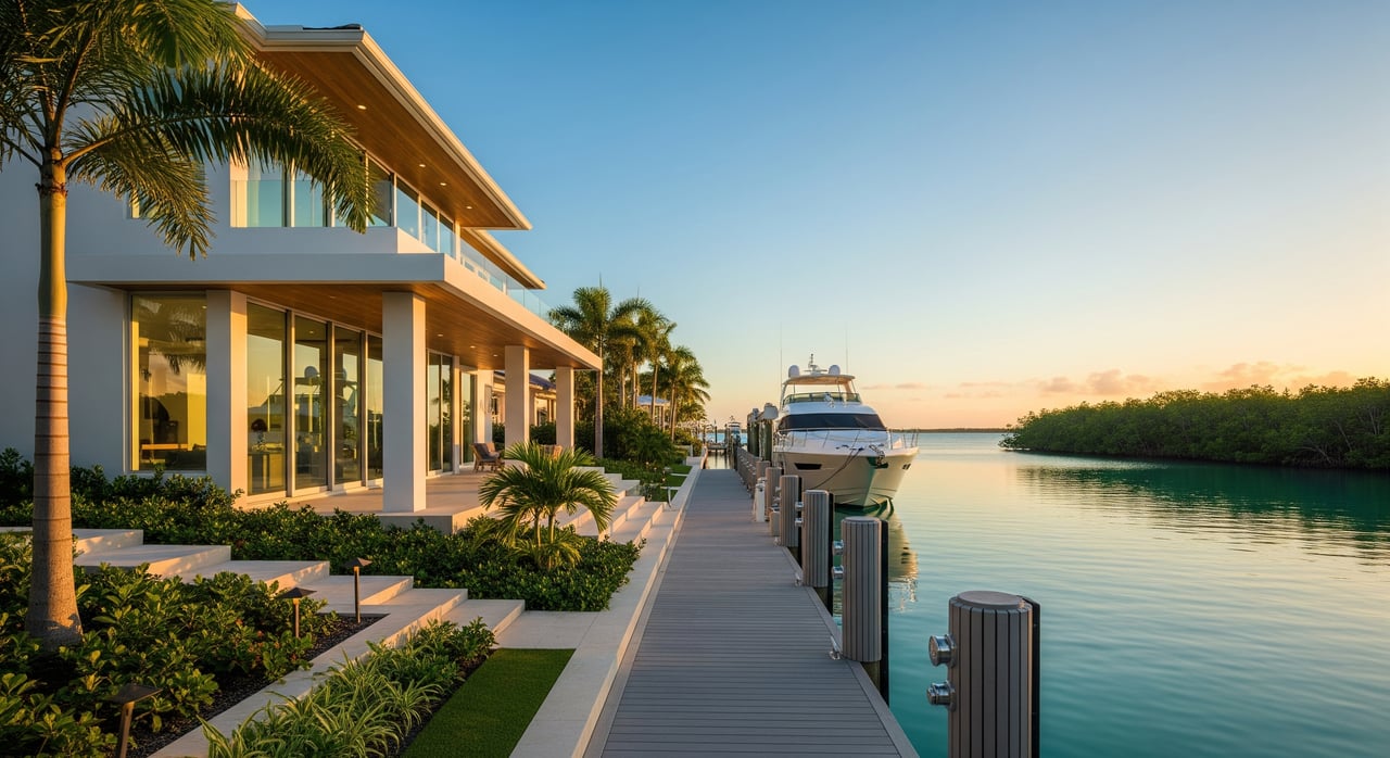
Direct motorboat access
This means the property’s canal connects to a continuous, navigable route to the Caloosahatchee River, Pine Island Sound, or Matlacha Pass, and then to the Gulf, without encountering low fixed bridges that block typical powerboats. Routes may include high fixed spans or movable bridges that allow passage.
Typical fit: center consoles, trawlers, and most powerboats that don’t need tall mast clearance.
Indirect or restricted access
Here, the canal connects to open water, but the route includes one or more low fixed bridges, narrow or low-clearance chokepoints, or areas known for shoaling. You may need to time tides, remove a small mast, or avoid certain vessels.
Typical fit: small powerboats, pontoon boats, personal watercraft, and some smaller sailboats if the mast can be lowered.
Sailboat-access or tall-mast access
This is a bridge-free route that accommodates a vessel’s mast height from the property to open water. It is the most limited category in Cape Coral because low inland road bridges are common.
Typical fit: sailboats and catamarans that cannot or will not lower rigging.
Canal and bridge factors in Cape Coral
Canal layout and connectivity
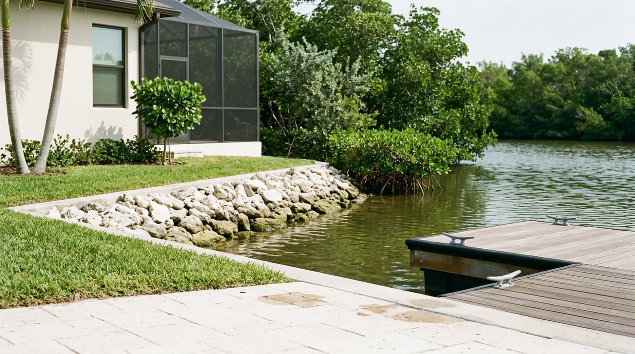
Cape Coral’s grid of man-made canals connects westward toward the Caloosahatchee River and Pine Island Sound/Matlacha Pass. What matters to you: how far the property sits from open water, the number of turns you must make, whether there are turning basins for larger boats, and the canal’s maintenance history. Longer routes and tight corners can add time and complexity.
Bridges and vertical clearance
Bridges control what can pass. High fixed spans allow most boats. Low fixed bridges limit air draft and can block sailboats and tall flybridge vessels. Movable bridges may have schedules and height limits when open. Always verify the posted vertical clearance for each bridge on your route, and compare it to your vessel’s air draft.
Depth, shoaling, and dredging
Canal depths vary and can be affected by shoaling. In some areas, depth can be shallower than charts suggest, especially in corners or near canal mouths. Ask for recent canal depth information and understand whether dredging is planned or has been performed recently.
Tides, wind, and wakes
Southwest Florida’s tidal range is modest, but it still affects minimum safe depth in shallow canals and inlets. Wind and boat wakes can also impact docking safety and maneuvering. If your draft is close to the canal’s low-water depth, plan transits carefully.
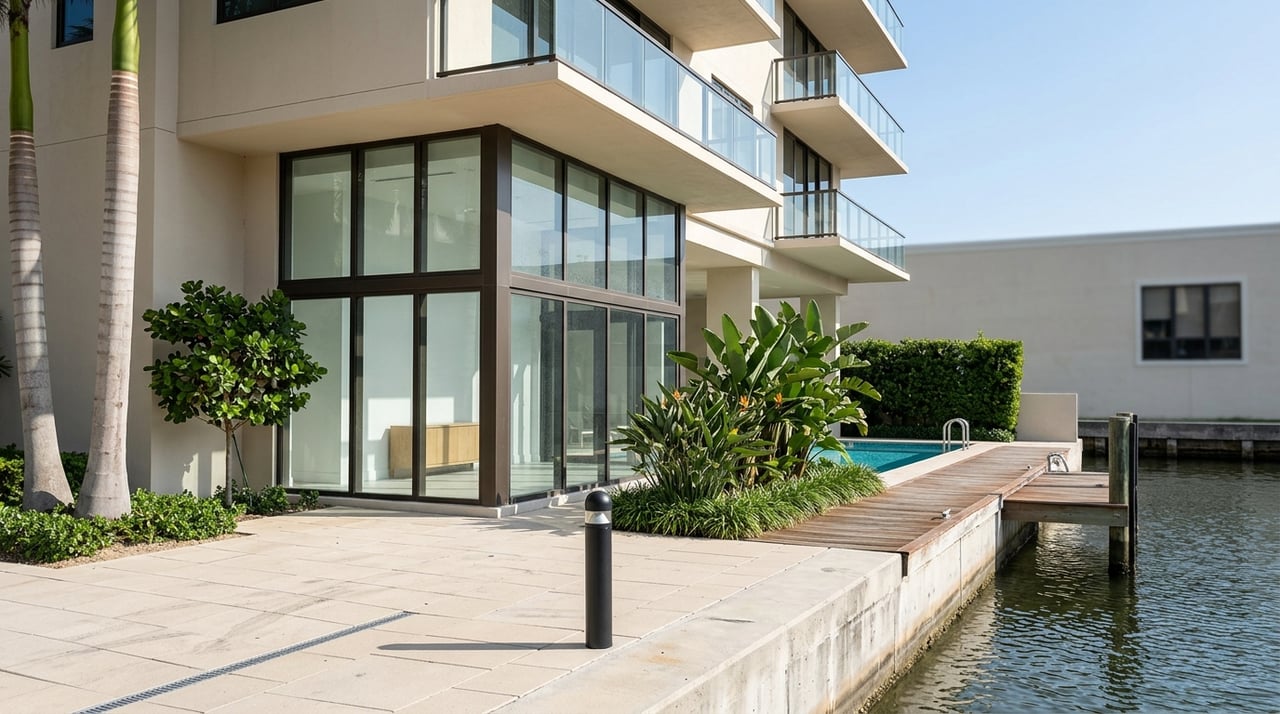
Seawalls, docks, and permits
In most cases, owners are responsible for seawall and dock maintenance and for obtaining permits for new construction or repairs. Local ordinances, flood maps, and environmental rules can affect what you can build. Ask for copies of permits and recent seawall inspection reports before you commit.
Match your boat and lifestyle
Know your vessel measurements
Have these numbers handy:
- Length overall (LOA)
- Beam
- Draft
- Mast height and air draft (from waterline to the tallest point)
Map measurements to constraints
- Vertical: Compare your air draft to each bridge’s posted clearance on your route to open water.
- Horizontal: Ensure canal width and turning basins can accommodate your beam and turning radius.
- Depth: Compare your draft to the most recent low-water depths for the canal and route.
Estimate travel time to open water
Use a simple, repeatable method:
- Measure the nautical miles from the dock to your chosen open-water point using reliable nautical charts or charting apps.
- Divide distance by your typical cruising speed in knots to estimate underway time.
- Add buffer for slow canal speeds, possible bridge openings, and prep or rigging time for sailboats.
Example: If the property is X nautical miles from Matlacha Pass and you cruise at Y knots, the transit is about Z minutes, plus time for canal maneuvering and any bridge openings.
Typical use cases to consider
- Weekend center-console trips: Often fine from direct or indirect routes, depending on bridge height and canal depth.
- Regular day-sailing or overnighting: Requires a verified sailboat-access route with adequate mast clearance the entire way.
- Liveaboard or frequent cruisers: Favor direct routes without low bridges, predictable depths, and generous turning basins, ideally near services that handle larger vessels.
Due diligence checklist before you offer
Use this list to verify a property supports your boat and boating plans.
Property and waterway verification
- Request a canal connectivity map that shows the full route from the dock to open water.
- Ask for recent canal depth information, or commission a survey as a contingency.
- Confirm whether any private gates, seawalls, or easements restrict navigation.
Bridges and route checks
- Obtain official vertical clearance figures for every bridge on your route.
- If a bridge is movable, get the current opening schedule and height when open.
- Confirm local restrictions such as no-wake zones, speed limits, or seasonal closures.
Dock, seawall, and permits
- Request copies of dock and seawall permits and the most recent inspection reports.
- Verify whether the dock will safely fit your boat’s LOA, beam, and required utilities.
- Confirm whether lifts or pilings are permitted and what size is allowed.
Environmental, HOA, and local rules
- Review city and county rules for docks, pilings, lifts, and seawalls.
- If there is an HOA, read rules on boat size, types, and dock use.
Insurance, financing, and resale
- Ask your marine insurance provider about coverage limitations tied to route type and distance to open water.
- Consider resale: indirect-access homes appeal to a different buyer pool than direct or sailboat-access homes.
Recommended professional checks
- Title and plats for any waterway easements.
- Marine surveyor or independent hydrographic survey for depths and dock capacity.
- Input from local marinas or tow providers about typical shoaling and best routes.
- Permit history from local building departments and official bridge data from transportation or coast guard authorities.
Suggested contingency wording you can adapt: “Seller to provide a certified canal depth survey dated within the past 6 to 12 months, plus documentation of bridge clearances and any bridge opening schedules affecting navigation to open water.”
Ready to see which listings truly fit your boat and lifestyle? Work with a specialist who treats access like a must-have, not a maybe. Heather Porrett can help you focus your search, request the right documents, and avoid surprises at closing.
Who to contact for verification
- Nautical chart sources for routes, shoals, and aids to navigation
- City permitting and docks or seawalls departments for local rules and permit history
- County GIS and property records for parcel and shoreline data
- Transportation and coast guard authorities for official bridge clearances and opening schedules
- Local marinas, yacht clubs, and marine surveyors for on-the-water guidance
How agents and MLS fit into the process
MLS fields are a helpful first screen, especially for identifying waterfront properties and general access. Still, you should confirm the exact route and any limits that affect your vessel. Ask your agent to help assemble charts, surveys, permits, and bridge data so you can move forward with confidence.
Buying along Cape Coral’s canals is about more than a view. It is about whether your boat and your daily routine fit the route to the Gulf. If you want a curated, technically sound approach to your shortlist, partner with Heather Porrett to align boat specs, canal realities, and long-term value.
FAQs
What “Gulf access” means for your boat
- “Gulf access” on a listing is a starting point. Verify the full route, bridge clearances, canal depths, and turning room for your specific vessel.
Direct vs. indirect access in Cape Coral
- Direct motorboat access avoids low fixed bridges and suits most powerboats. Indirect access includes low bridges or shoaling that can limit boat size and timing.
Sailboat-access routes with tall masts
- A sailboat-access route must be free of vertical obstructions for your mast height from dock to open water. Always confirm posted clearances along the entire route.
Canal depths and dredging responsibilities
- Depth maintenance varies by canal and channel. Some areas rely on public projects, others on private or special-district efforts. Ask for recent depth information.
How tides affect leaving your dock
- Even with a modest tidal range, low tide can reduce safe water under your keel in shallow canals. Compare your draft to low-water depths before planning departures.
Adding or enlarging a dock or lift
- You may be able to, subject to permits and environmental rules, and possibly HOA approval. Verify what is allowed before making plans or offers.